Yaya Simulasyonu ile Şehirlerdeki Kargomatların Konumlarının Belirlenmesi
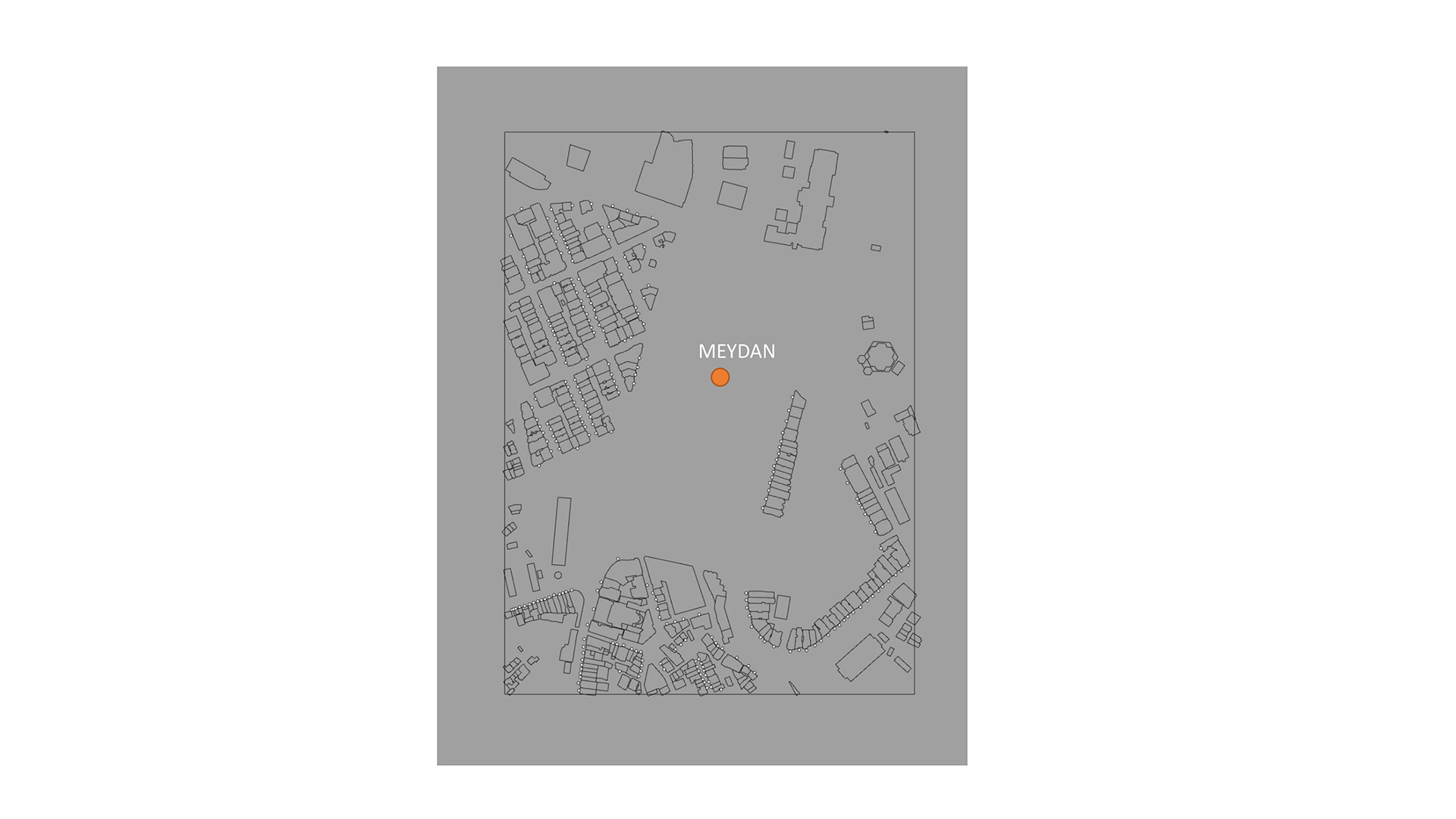
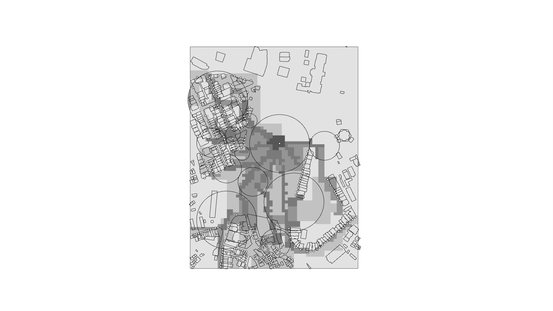
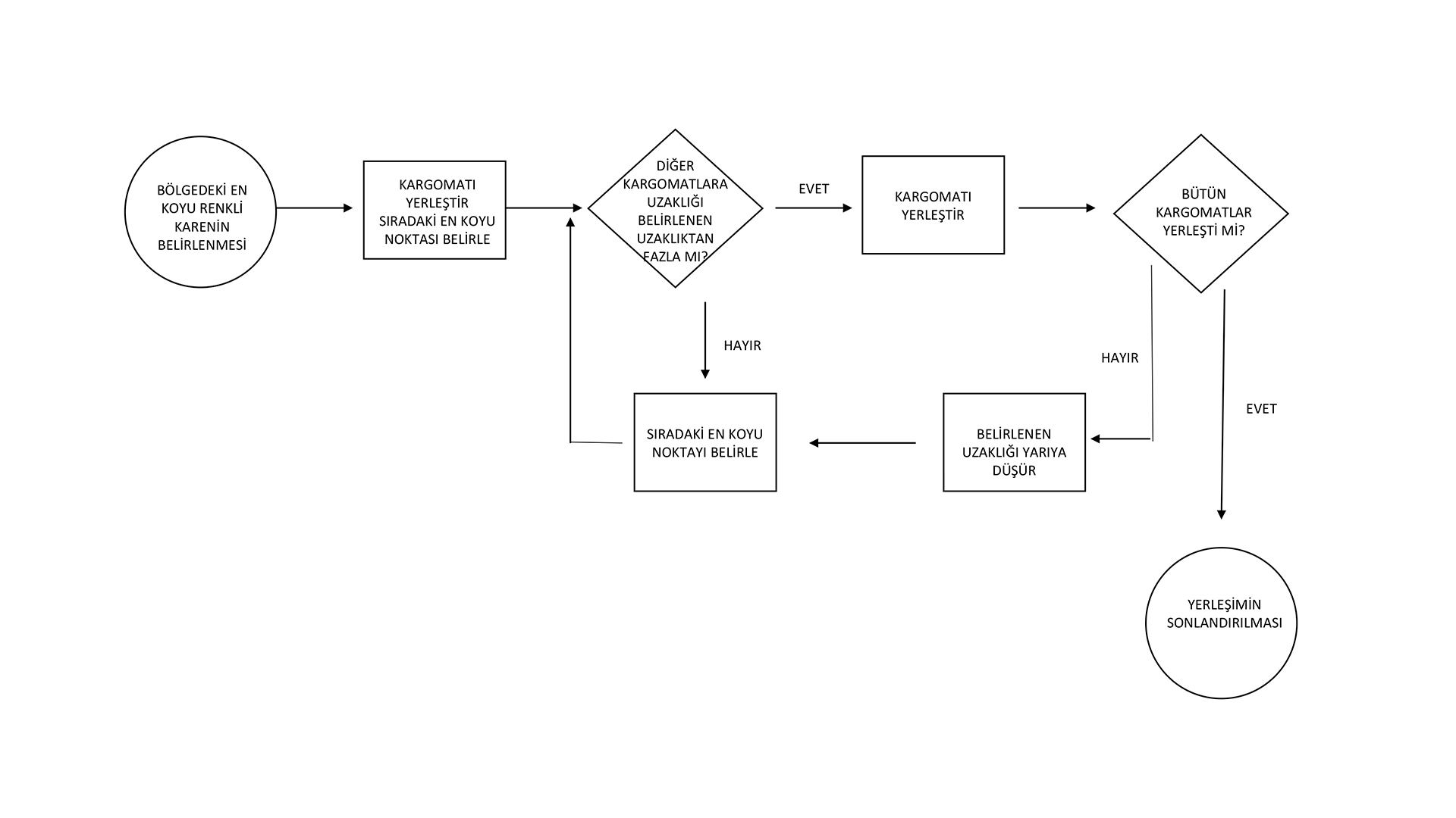
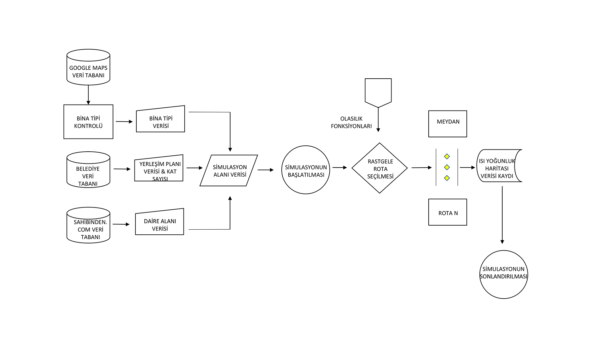
Bilgi ve iletişim teknolojilerindeki gelişmeler; toplumsal ve ekonomik alanda değişimi ve dönüşümü beraberinde getirmiştir. Ekonomik gelişme, rekabet üstünlüğü ve toplumsal refahın sağlanmasında “bilgi toplumu” ve “e-ticaret” stratejik bir önem kazanmıştır. (Canpolat,2001) E-ticaretin büyümesi, beraberinde sevkiyat/taşımacılık endüstrisinde de büyüme ve gelişmeye yol açmıştır. Sevkiyat endüstrisine artan taleple, kargo firmalarının kapasitesi yetersiz gelmeye başlamıştır ve talebi karşılayabilmek adına inovatif çözümlere doğru yönelmişlerdir. Bu inovatif çözümlerden biri de, kargomatların üretilmesidir. Kargomatların şehirlerde yerleşeceği noktaların optimal bir şekilde belirlenmesi, erişilebilirlik ve efektif kapasite kullanımı açısından önem arz etmektedir. Bu projenin amacı, kargomatların konumlarını belirlemede kullanılacak bir model önerisi sunmaktır. Önerilen model, yaya simülasyonunda olasılık fonksiyonlarının konut verileri yardımıyla manipüle edilmesiyle oluşturulmuştur. Projenin ilk aşamasında, şehirdeki konut verilerinin kullanılması ile insan yoğunluğu öngörülmektedir. Öngörülen yoğunluk bilgisinin kullanımıyla, yaya simülasyondaki rotaların olasılık fonksiyonları belirlenmektedir. Yaya simülasyonda kullanılacak rotalar, ulaşım istasyonu ve konutlar arası olarak belirlenmiştir ve simulasyon sonucu elde edilen yoğunluk bilgisi, gridal bir ısı haritasına aktarılmıştır. Yoğunluk ısı haritası ile kargomatların konumları belirlenmiştir. Bu projede önerilen model, İstanbul Taksim Meydanı’nın belirlenen sınırlarında test edilmiştir.
Determining the Locations of Cargomat in Cities with Pedestrian Simulation
Developments in information and communication technologies; It has brought about change and transformation in the social and economic field. “Information society” and “e-commerce” have gained a strategic importance in economic development, competitive advantage and social welfare. (Canpolat,2001) The growth of e-commerce has also led to growth and development in the delivery/shipping industry. With the increasing demand in the shipping industry, the capacity of the cargo companies has started to be insufficient and they have turned towards innovative solutions in order to meet the demand. One of these innovative solutions is the production of Cargo lockers. It is important to determine the points where the cargo lockers will be placed in the cities in an optimal way in terms of accessibility and effective capacity utilization. The aim of this project is to propose a model to be used in determining the positions of the cargo lockers. The proposed model is created by manipulating probability functions in pedestrian simulation with the help of housing data. In the first phase of the project, human density is foreseen by using housing data in the city. Using the predicted density information, the probability functions of the routes in pedestrian simulation are determined. The routes to be used in pedestrian simulation were determined as transportation station and between residences and the density information obtained as a result of the simulation was transferred to a gridal heat map. The locations of the cargo lockers are determined with the density heat map. The model proposed in this project has been tested in the determined boundaries of Istanbul Taksim Square.
© 2021 Istanbul Technical University Graduate School, Department of Informatics, Architectural Design Computing Program. All Rights Reserved